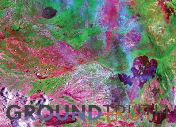
Ground Truth – Fire, Flood and Human Endeavour, is inspired by the science of remote sensing: using data from satellites, airborne sensors and ground-based platforms to map and monitor vast landscapes and how they change over time.
This exhibition is a unique collaboration by new media artist Grania Kelly with Queensland Government remote sensing scientists and visualisation experts at QUT Institute for Future Environments.
Grania said the exhibition reflects a deeper story of place and change. “The surface of our Earth is changing faster than ever before in known history,” she said. “The work presents the intertwining, ever-morphing and cyclical imprint that people and nature have on landscapes we call home.”
Surprising, vivid and revealing. The Ground Truth immersive media exhibition brings to life satellite imagery of the Greater Brisbane Region, the Channel Country and Cape York to show us how humans and nature are changing the environment we live in.
Step forwards and backwards through time and sound for an interactive journey through some of Queensland’s most cyclical and rapidly changing landscapes.
Image:South-Western Cape York – November 5, 1996. Landsat 5 TM image courtesy of U.S Geological Survey